Central Indiana lies within the Wabash River Drainage Basin, with both Hamilton and Marion counties predominantly belonging to the White River Subbasin. Glaciers formed this topography about 20,000 years ago, with the waterways winding and changing shape for thousands of years while establishing White River as the central waterway to this area. Tributaries Stony Creek and Cicero Creek feed into White River in Hamilton County while Fall Creek and Eagle Creek feed into Marion County. The northernmost anchor of White River within Hamilton County lies in the North Reach, from the Lafayette Trace south to 206th Street, which is just south of Strawtown Koteewi Park. To the south of Strawtown are the sister communities of Riverwood and Clare, unincorporated territories of the county.
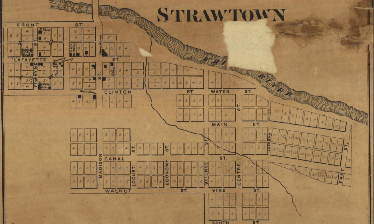
Early Native occupants of this land included many Great Lakes tribes: the Myaamia (Miami Nation), the Kaskaskia (Peoria Tribe), Kiikaapoi (Kickapoo), and later the Lenape (Delaware Tribe). As white settlers traveled into what would become Hamilton County, a year after the 1818 Treaty of St. Mary’s, Strawtown was one of the earliest settlements – established in 1820 and laid out by Bicknell Cole and William Conner. Hamilton County, named after Alexander Hamilton, was organized in 1823, as nine townships covering about 400 square miles. These initial pioneer settlements developed along transportation routes – particularly on waterways and trading post paths used by Native Americans and early white traders. Strawtown was both, as a previous Native American village and adjacent to the river, an ideal location for a town. Settlers established mills and farms along the river, developing trading posts and early commerce markets, while additional land was purchased by both settlers and land speculators via the federal government’s General Land Office program. The promise of waterway travel peaked in 1836 with the Indiana Mammoth Internal Improvement Act, which hoped to connect growing towns by a series of waterways, canals, and roads. One strip of canal was completed in Marion County to the south, but ultimately this project was deemed a failure as it bankrupted the state and was determined that the White River would not be navigable by large boats. In addition, Noblesville had already been selected as Hamilton County’s county seat over Strawtown in 1824, diminishing the likelihood that Strawtown would develop beyond an unincorporated modest village. As roads and railroads continued to develop through the mid-1800s, connecting geographically convenient towns and villages, Strawtown seemed destined to be ignored. But by the 1890s, the gas boom reached Strawtown, fueling much of the area with four substantial pump engines. Mussels were another prolific business for the town, until the crop decreased in numbers in the 1930s. Strawtown still exists as an unincorporated territory of White River Township, in northeastern Hamilton County, with several homes and farms alongside the river to the north and the park to the west.
Strawtown Koteewi Park, the North Reach’s anchor, is the largest park in Hamilton County, with around 800 acres of land along 3 miles of the White River. Created in 1999, the woods, prairies, and wetlands of the park may have appeared to be underdeveloped, but in reality contained multiple archaeological sites significant to the Native American communities divested of their land and resources. The park offers hiking, biking, and horseback riding trails, along with educational programming, an archery range, and a canoe launch.
Tagged in: History, Storytelling, Strawtown


